In addition to being a graphic designer, I'm also a hiking guide book author. These custom maps were created for my I Heart Pacific Northwest hiking books.
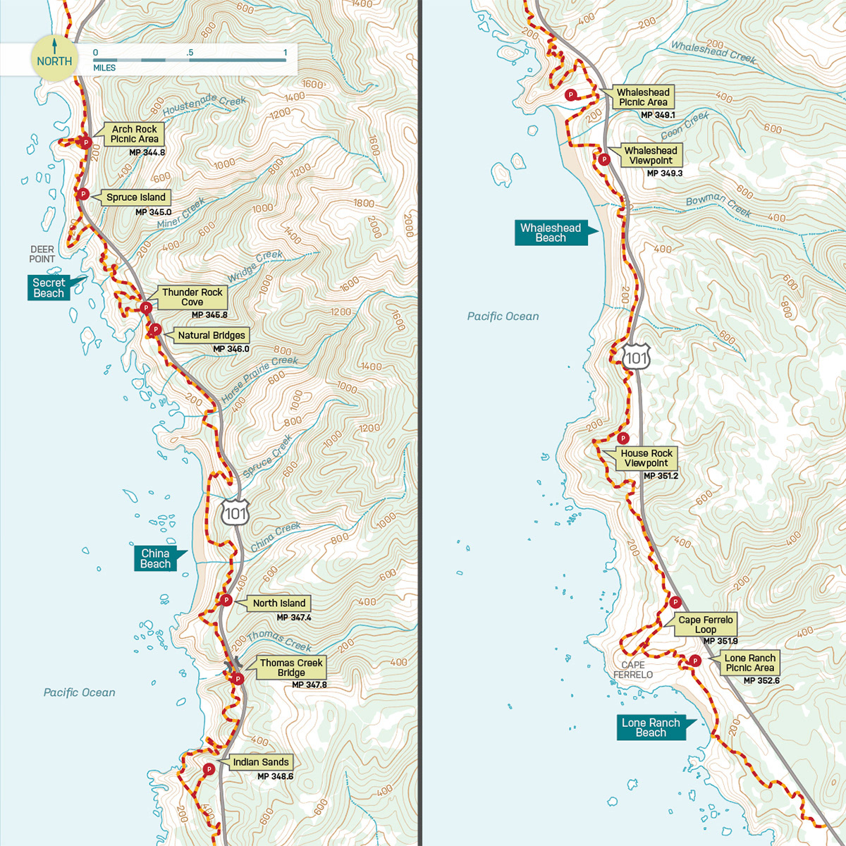
One of the unique aspects of the guide books I design are the custom maps. I strive to create maps that are easy to read yet have elements that are important for good navigation on trail. Priorities are topography contour lines, terrain backgrounds, point to point mileage, and trail features including the names of waterfalls, viewpoints, and more.
For the trail maps, my process includes beginning with public domain topography maps and open-source terrain maps, extracting only the elements that I want to use, including contour lines, water sources and forest coverage. Once I have the base map with topo contour lines, rivers, streams and lakes, I crop the map to the specific area needed, and then transfer these elements to a template file used for this project. Then I redraw all of the trails, roads and other details. The next step is to add trail highlights, terrain backgrounds, labels, and mileage markers. To get accurate data, I review a combination of sources including my own GPS tracks, topography maps, and online data from land managers.
For the larger overview maps, I use a combination of online sources such as open-source terrain maps and re-color them to match the desired color scheme. Once I have the base map in place, I re-draw all of the roads and add labels in Adobe Illustrator.
For more info on my hiking books, visit I Heart Pacific Northwest.