


Mapping a Solution
On a summer day in 2006 I was mountain biking with a good friend at Renaissance Park in Charlotte, North Carolina when we encountered someone that had been injured. Another rider had called 911 and was tending to the injured person and told us that the EMT was on the way. We rode back to the trailhead in order to help guide the EMT personnel to the where the injured person was located. Although I had biked this trail many times I was not sure of a shortcut, so we had to follow the trail and it took some time to get the EMT to the person who needed care.
We were able to assist the EMT carry the injured person back the parking lot but this event left me wondering if we could have provided EMT with a faster route to the injured person. A solution I came up with was to create a map of the trail that could be posted at the trailhead. I did some research and I learned that a group called the Tarheel Trailblazers (TTB) constructed and maintained mountain bike trails in the Charlotte area. I contacted their president at the time, Tom Matthews, and informed him about the emergency that had taken place at Renaissance Park and discussed the idea of working with TTB to create maps of the trails they built and maintained. Tom told me that this was something the TTB had been developing and would be interested in my assistance with their project.
I soon met with Tom and another member of TTB, Ivan Konnermann. We discussed a plan for creating the maps. We determined that the first maps would be created for the Renaissance Park and Catawba River trails which were the most popular trails in the Charlotte area. An idea I brought to the meeting was that TTB could create maps, place some minimal advertising on them to cover cost of printing and then distribute them to local bike shops to sell. The sale of these maps would be a great way for the TTB to raise money to continue to create, maintain and mark trails.
At the time we started developing the initial maps, the trails near the Catawba River were being incorporated in the grounds of the United States National Whitewater Center (USNWC). Tom and Ivan informed the staff at the USNWC that we were working on a map for the trail system there. With the GPS data that Ivan gathered and additional input from the USNWC the TTB provided the artwork that was printed for the initial trialhead signage at the USNWC. The TTB also printed and supplied the USNWC with maps to sell at their store. The TTB later sold the artwork to the USNWC they could update the map as more trails were constructed on their land. The funds collected from the sale of the maps and editable artwork to the USNWC has allowed the TTB to purchase equipment and materials for building and marking safe trails.
Since 2006 the TTB organization has continued their great work on the trails in the Charlotte area and I have continued to work with them on maps. Please visit www.tarheeltrailblazers.com for more information about this organization and learn about all the great mountain biking trails located in the Charlotte area.
Below are samples of some of the maps that we created.
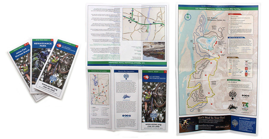
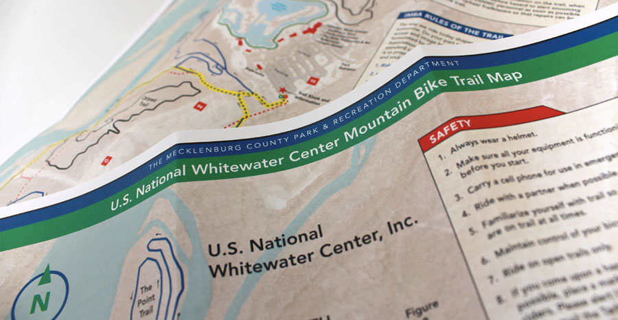
U.S. National Whitewater Center Trail Map (2007)
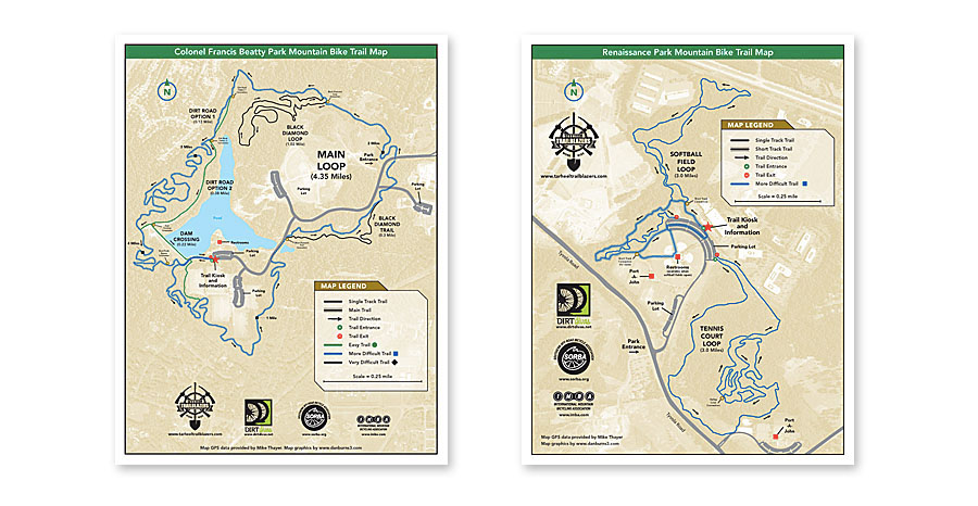
Colonel Francis Betty Mountain Bike Trail Map (2011) / Renaissance Park Mountain Bike Trail Map (2011)

Sherman Branch Mountain Bike Trail Map (2011) / Lake Norman State Park Mountain Bike Trail Map (2012)
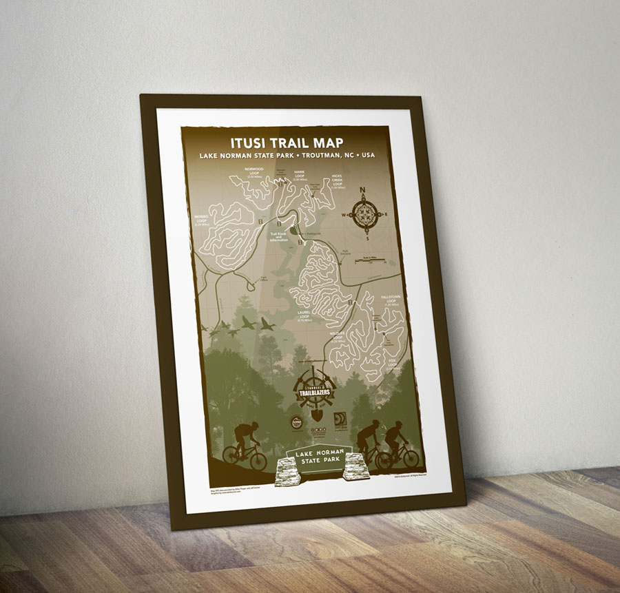
Poster print of Lake Norman State Park Mountain Bike Trail Map


