Trains are the lifeline of a big country like India. Indian Railways is an state-owned enterprise, owned and operated by the Government of India through the Ministry of Railways. It is one of the world's largest railway networks comprising 115,000 km (71,000 mi) of track over a route of 65,000 km (40,000 mi) and 7,500 stations.
We had a 1 day workshop with S. Anand from Gramener and at the end of the day we had to choose a dataset and hack together a visualization in a day. This timeline was later expanded to include the attached weekend. I worked as part of a 2 member team (with Shweta) and we were one of the teams that chose the Trains dataset. The documentation of our approach to visualizing this dataset can be viewed on this tumblr.
We had a 1 day workshop with S. Anand from Gramener and at the end of the day we had to choose a dataset and hack together a visualization in a day. This timeline was later expanded to include the attached weekend. I worked as part of a 2 member team (with Shweta) and we were one of the teams that chose the Trains dataset. The documentation of our approach to visualizing this dataset can be viewed on this tumblr.
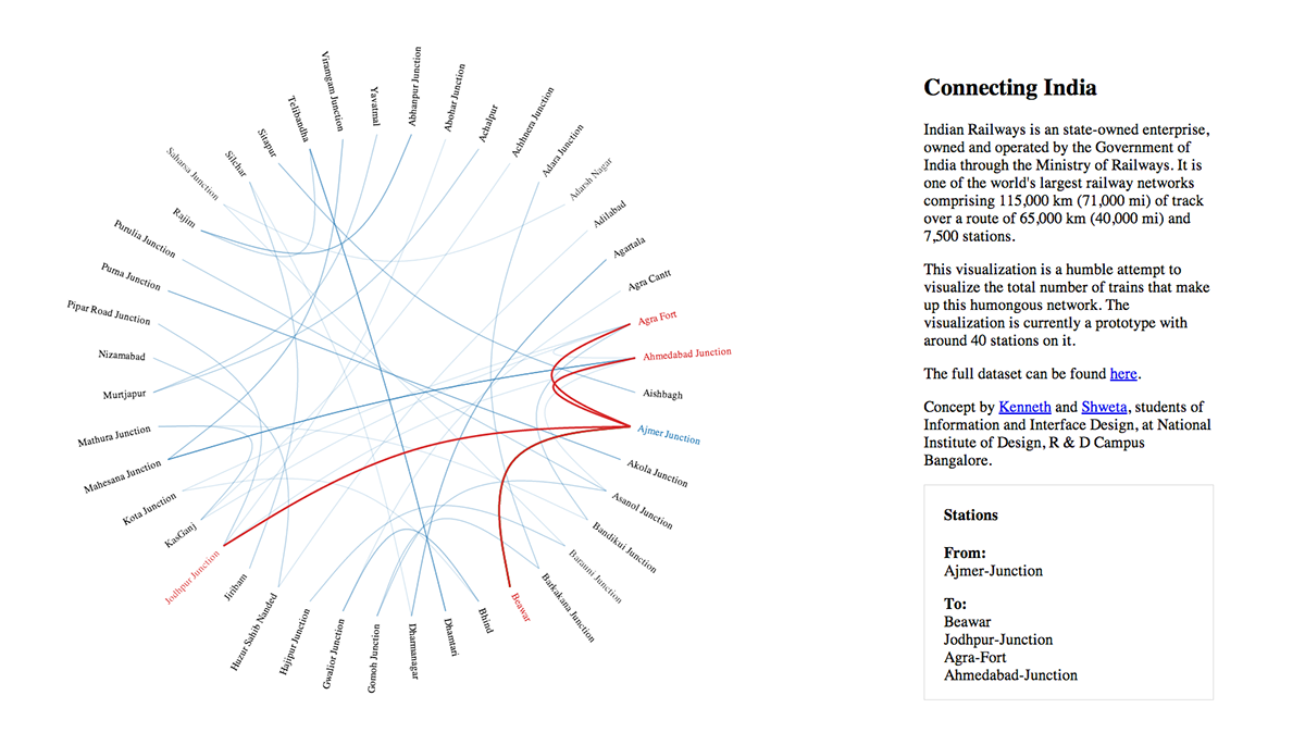
This visualization is a humble attempt to visualize the total number of trains that make up this humongous network. The visualization is currently a prototype with around 40 stations on it. This is because we had some issues scaling the visualization to be interactive for all the 5000 trains.
The latest version of the visualization can be viewed at bit.ly/trainviz
The latest version of the visualization can be viewed at bit.ly/trainviz

