Florent Lavergne's profile

Cartography: The Colorado Mountains

Infographic
Illustrator
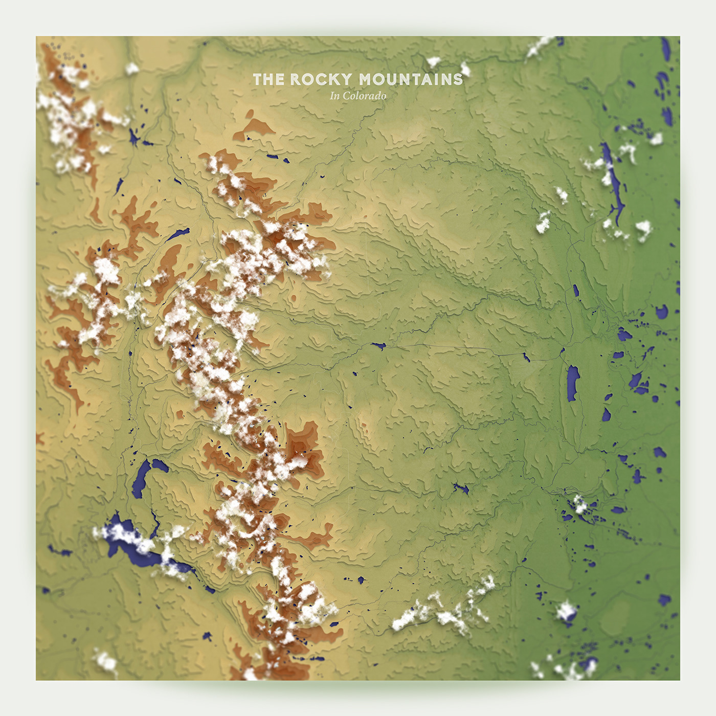
The Rocky Mountains, Colorado

Stretching over 4800 km across the United States and Canada, the Rocky Mountain range offers dramatic landscapes and diverse wildlife. I have spent countless hours hiking Northern Colorado trails, and designed this topographic map as an homage to the region.​​​​​​​
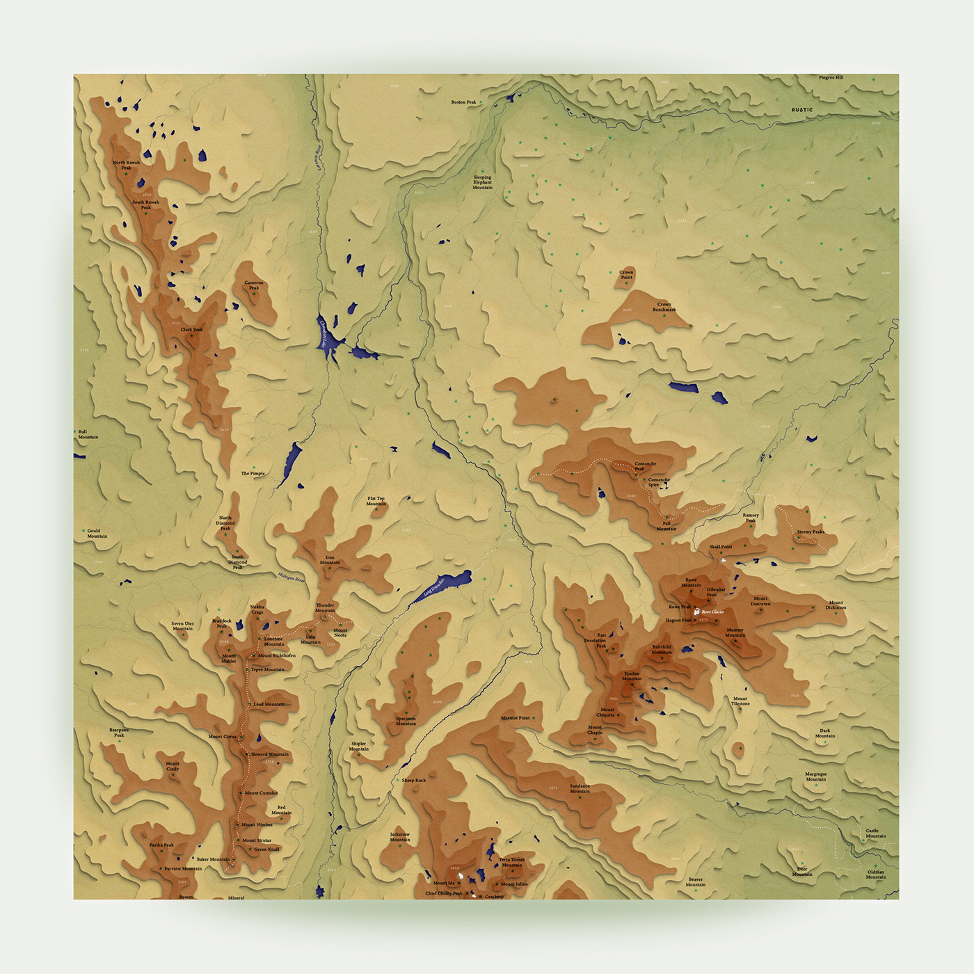
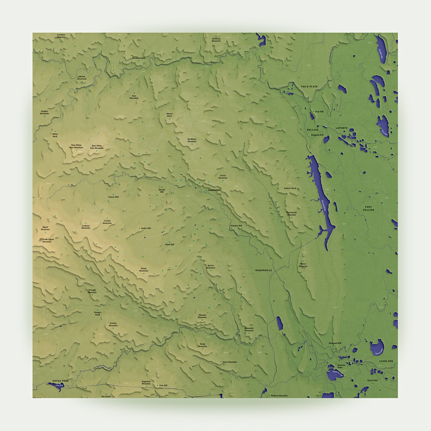
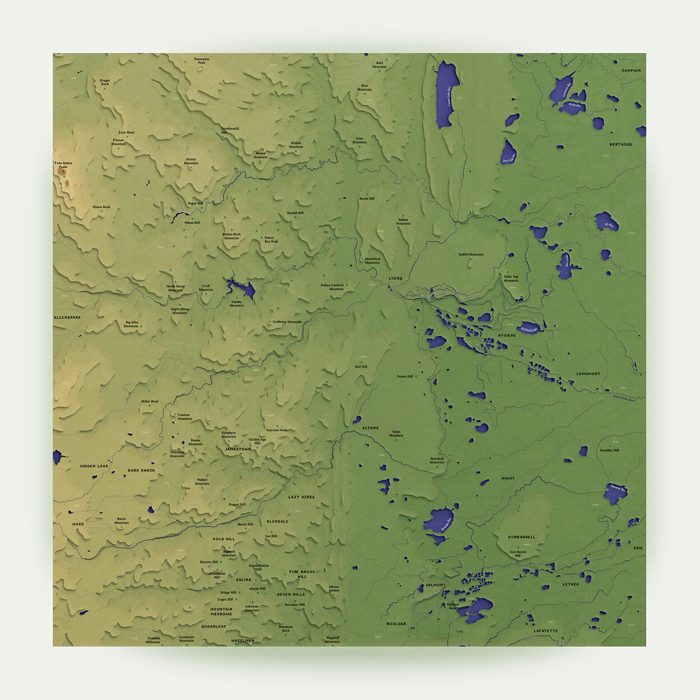

Close-Up View

Below you can see quadrants of the map with labeled peaks, rivers, lakes, glaciers, and local elevation. The Rocky Mountain National Park boundaries are shown as white dots. Interestingly, while the area covered in the artwork merely exceeds 80 x 80 km, elevation spans almost 3000 meters that's about the height of 10 Eiffel Towers!
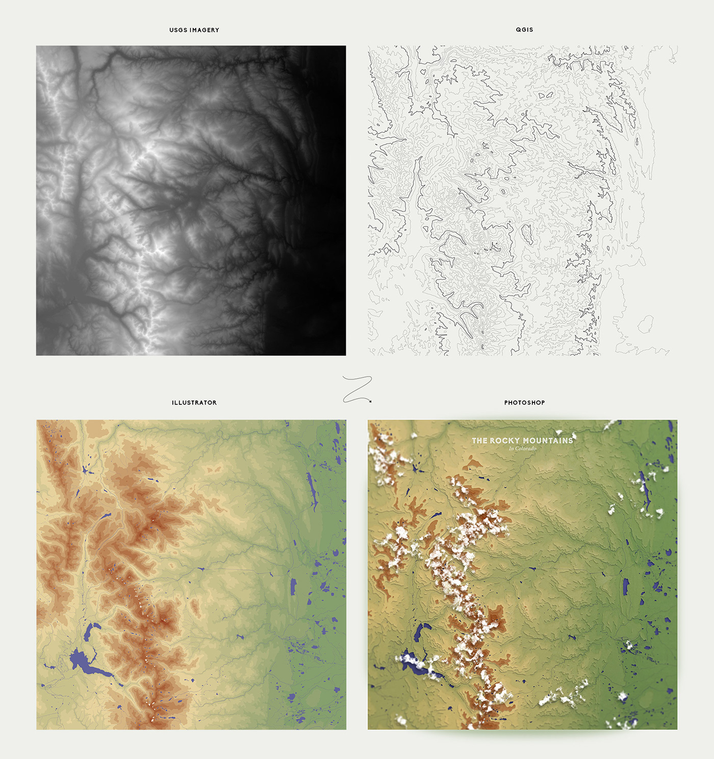

Workflow

I started out the design by retrieving satellite images of Colorado from the US Geological Survey database, and generating elevation layers via a geographic information system (QGIS). Then, I gathered additional terrain data such as water bodies and peak location from OpenStreetMap. The final steps consisted in putting all these elements together in Illustrator and styling them in Photoshop.


Alternate Version

You can check out an abstract version of the map below and, if you look long enough, may be able to spot some fish and seahorse shapes :).
Cartography: The Colorado Mountains
Published:

Owner

Cartography: The Colorado Mountains

This is a topographic map of the Rocky Mountain National Park and its surroundings, in Northern Colorado. My design workflow consisted in retriev Read More

Published: